
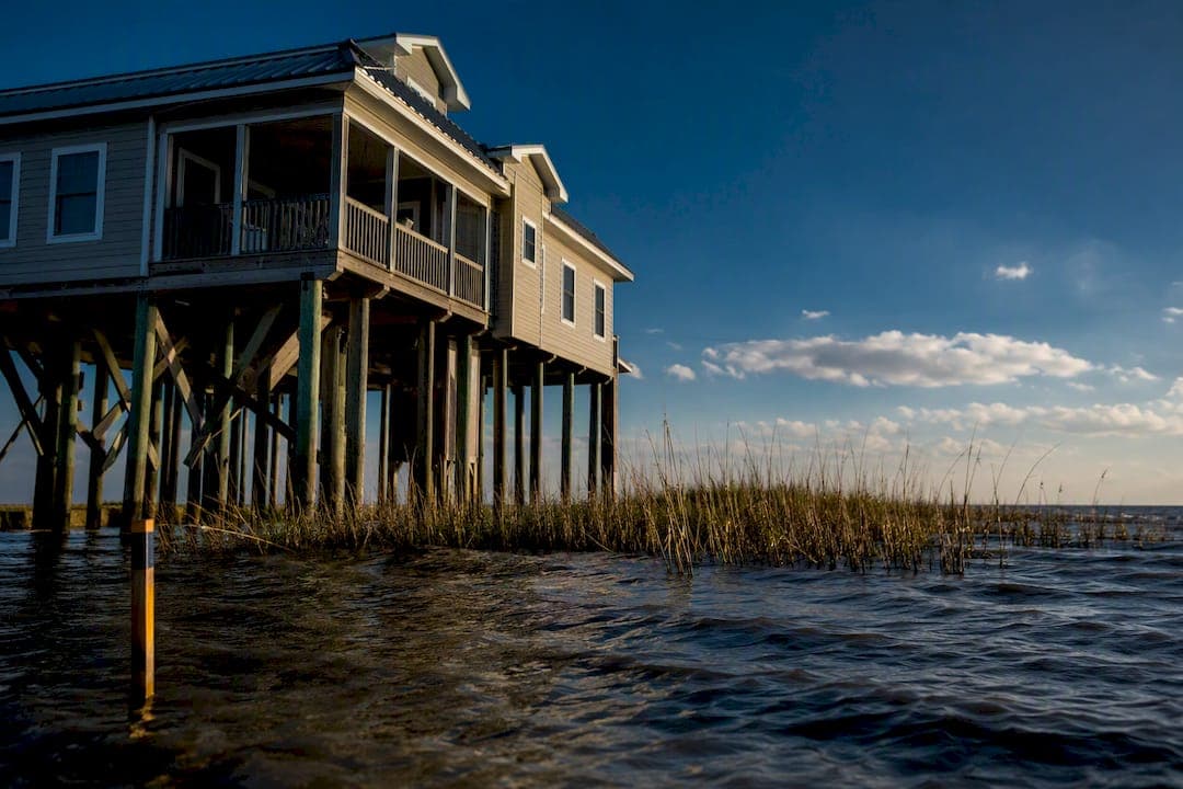
3 Foot Wave Risk: AE vs VE Flood Zones for Louisiana Homeowners
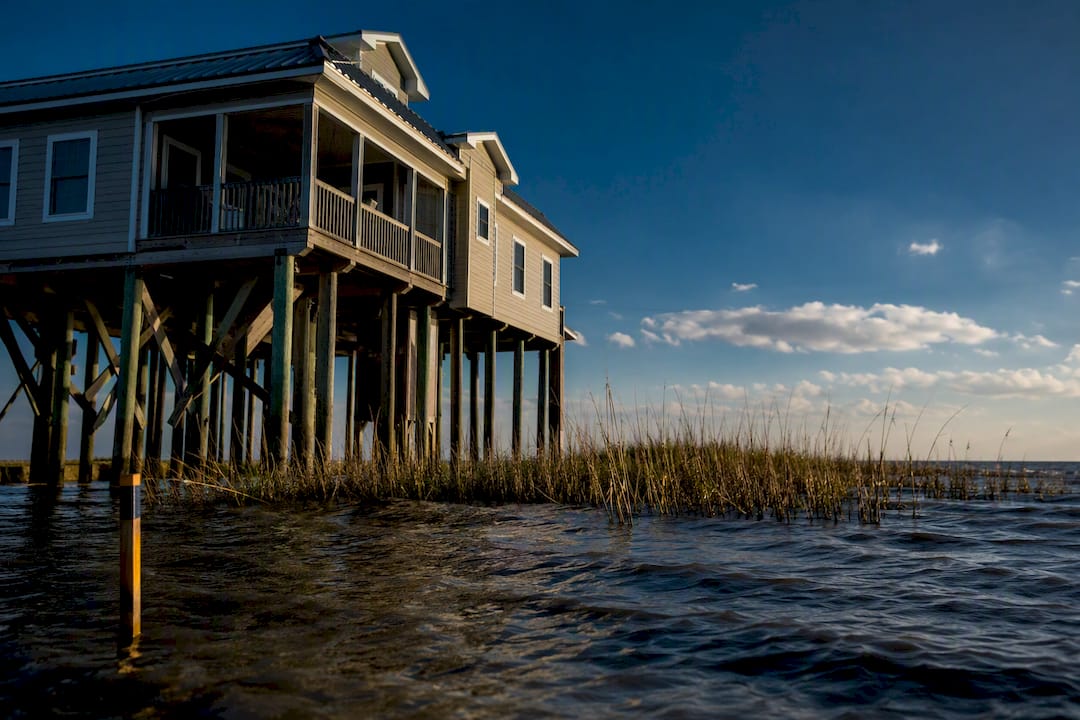
Both Zone AE and Zone VE carry a 1% annual chance of flooding, the threshold FEMA calls the base flood. The difference that actually changes your building plans and your premium is wave action: VE zones face breaking waves of at least 3 feet, while AE zones see stillwater flooding or smaller waves. That single distinction pushes VE properties toward pile foundations, bans fill for structural support, and drives insurance costs well above what a comparable AE home pays.
TL;DR:
- VE zones require building on pile foundations with breakaway walls, significantly increasing construction costs compared to AE zones, which allow solid foundations.
- The boundary between AE and VE zones is precisely mapped based on wave runup exceeding three feet, not just flood depth, influencing both building standards and insurance premiums.
- Many Louisiana parishes enforce higher elevation standards than NFIP minimums, so verifying local rules is crucial before building or purchasing a property.
- Elevating above the base flood elevation can lower insurance costs in either zone, but VE premiums substantially remain higher due to the wave hazard risk.
- Accurate flood zone verification and proper documentation, such as elevation certificates, are essential for optimizing insurance rates and ensuring compliance during property transactions.
Table of Contents
- What Is Zone AE on a Flood Map?
- What Is Zone VE and Why Does Wave Action Change Everything?
- AE vs VE: The Differences That Actually Affect Your Decisions
- How BFEs, VE Boundaries, and LiMWA Actually Work
- How to Confirm Your Flood Zone Before You Buy or Build
- Why Louisiana Parishes Often Require More Than the NFIP Minimum
- Where AE and VE Zones Typically Show Up on the Map
- How AE and VE Mapping Has Changed Over Time
- Does a VE Designation Hurt Your Property’s Resale Value?
- Steve Root’s Take: Coverage and a Local Agent Beat a Lower Premium
- Get Your Flood Zone and Coverage Reviewed by a Local Expert
- Sources
What Is Zone AE on a Flood Map?
Zone AE marks land with a 1% annual chance of flooding where FEMA has calculated a specific Base Flood Elevation, or BFE. You’ll find AE zones inland along rivers and bayous, and along coastlines where wave heights during the base flood stay under 3 feet. The BFE is the number that matters most here. It tells you how high your home’s lowest floor needs to sit, and it’s the figure your insurer uses to rate your National Flood Insurance Program policy.
If your home sits below the BFE, expect higher premiums. Sit at or above it, and the numbers improve substantially, sometimes enough to justify the cost of raising a structure during renovation.
Confirming AE status isn’t guesswork. Check for these on your property’s flood map panel:
- A “AE” zone label with a numeric BFE listed (such as “AE (EL 12)”)
- Your parcel located within the shaded Special Flood Hazard Area boundary
- Cross streets or landmarks matching your actual address on the panel
- A panel effective date recent enough to reflect current mapping
What Is Zone VE and Why Does Wave Action Change Everything?
Zone VE is FEMA’s designation for coastal high-hazard areas, where wave action and high-velocity flow during the base flood can cause extensive structural damage that AE-level stillwater flooding typically does not cause. VE mapping isn’t just about depth. FEMA uses wave runup criteria tied to the Primary Frontal Dune to draw the boundary, accounting for the force of water moving, not just rising.
That force is why VE construction rules look nothing like AE rules. A home in VE has to meet criteria that treat the space below the lowest floor as something water must pass through unobstructed, not something to build around.
VE construction standards typically require:
- Pile or column foundations, not fill or solid perimeter walls, so waves pass beneath the structure
- Breakaway walls below the BFE, engineered to collapse under specified loads rather than transfer wave force to the pilings
- Certification from a registered design professional confirming the foundation design meets FEMA’s V-zone criteria
The FEMA quick reference guide comparing NFIP and 2018 I-Code requirements lays out exactly why breakaway walls matter structurally: if an enclosure below the BFE is built too sturdy, it traps wave forces instead of releasing them, and that trapped force can pull the entire foundation down. That engineering detail explains much of the construction complexity and added cost that differentiates VE builds from AE builds.
AE vs VE: The Differences That Actually Affect Your Decisions
The risk itself looks different in each zone. AE flooding tends to rise and sit, damaging drywall, flooring, and mechanical systems through prolonged water contact. VE flooding arrives with force, breaking windows, ripping siding, and using floodwater-carried debris as a battering ram against anything that isn’t elevated on open pilings.
Construction rules follow that risk pattern:
- AE zones allow solid foundation walls, crawlspaces with flood vents, and in some cases dry floodproofing for non-residential structures.
- VE zones require open foundations, prohibit fill for structural support, and mandate breakaway construction below the BFE.
- Both zones may fall under stricter local rules than the NFIP sets as a floor, since municipalities can adopt higher standards.
Insurance is where the two zones diverge most sharply for your wallet. Flood insurance is mandatory in both AE and VE for any property carrying a federally backed mortgage, and lenders confirm coverage before closing in any NFIP-participating community. But VE premiums generally run higher than AE premiums for comparable structures, largely because the wave-hazard risk category assumes greater potential damage. Elevation above the BFE, often called freeboard, meaningfully lowers NFIP premiums in either zone, and whether your home is Pre-FIRM or Post-FIRM construction affects your rating too.
Don’t assume the NFIP minimum is your ceiling. Many Louisiana parishes adopt higher standards than the NFIP minimums, often including freeboard requirements, so check your parish ordinance before you finalize any building or purchase decision.
How BFEs, VE Boundaries, and LiMWA Actually Work
Base Flood Elevation is the projected water surface height during a 1% annual chance flood event, expressed in feet above a fixed reference datum. Everything downstream, your foundation height requirement, your insurance rating, your permit approval, traces back to this one number.
The VE/AE boundary itself is drawn using a specific technical threshold: areas where 2% wave runup reaches 3 feet or more above the stillwater elevation get mapped as VE; areas below that threshold stay AE. It’s a precise engineering line, not a rough coastal guess.
Between the two zones sits a feature many homeowners never hear about until it affects them: the Limit of Moderate Wave Action, or LiMWA.
- LiMWA marks the inland boundary where moderate wave heights (generally between about 1.5 and 3 feet) still occur during the base flood
- Properties between LiMWA and the VE line are officially mapped AE but may face wave hazards similar to VE
- FEMA’s coastal mapping guidance recommends VE-style construction in this zone even though the map label says AE
- Post-storm investigations have shown standard AE construction techniques can fail under waves smaller than the VE threshold, motivating the LiMWA delineation
If your AE property sits inland of LiMWA but near the VE boundary, building to VE standards anyway is a reasonable, defensible choice, even though the map won’t force you to.
How to Confirm Your Flood Zone Before You Buy or Build
Start with the source, not a guess based on your neighbor’s policy or your realtor’s memory.
- Pull your property’s map panel from the FEMA Flood Map Service Center at msc.fema.gov, or check FloodSmart.gov for a quick zone lookup.
- Request an Elevation Certificate for the property, current or from the seller, showing lowest-floor elevation relative to the BFE.
- Ask your local floodplain administrator whether the parish requires freeboard above the federal minimum.
- Gather any Letter of Map Amendment or Letter of Map Revision documentation if the property’s zone status has ever been formally disputed or changed.
- For VE properties specifically, confirm foundation plans carry a registered design professional’s stamp before you close.
Our detailed walkthrough on reading a Louisiana flood map and finding your zone covers how to interpret panel numbers and BFE callouts step by step.
Pro Tip: If you’re buying a coastal property near a LiMWA line, ask the seller’s insurer for their current NFIP rating worksheet. It shows exactly how the wave hazard classification affected their premium, which tells you what you’re inheriting before you sign anything.
Mitigation choices come down to trade-offs. Elevating a structure or relocating utilities above the BFE costs money upfront but lowers your annual premium for as long as you own the home. A mortgage calculator can help you weigh how a higher construction loan balance stacks up against years of reduced flood premiums before you commit either way.
Why Louisiana Parishes Often Require More Than the NFIP Minimum
Many Louisiana parishes require freeboard, elevation above the BFE, that exceeds NFIP’s federal floor, so checking local floodplain rules before you buy or permit work isn’t optional homework, it’s the difference between a smooth closing and a costly surprise.
The Root Agency reviews policies against actual parish mapping and elevation requirements, not just federal minimums. Our bilingual team backs that up with 24/7 claims support and a mobile catastrophe response unit that deploys to disaster zones in person. For VE properties, we recommend requiring stamped foundation plans and a current elevation certificate before closing, and keeping both on file for lender and insurer compliance.
Where AE and VE Zones Typically Show Up on the Map
VE zones cluster primarily along open coastlines and barrier islands where direct wave action from the Gulf or ocean can build force during storm surge, such as Gulf-facing parishes and major bay or sound frontages in Louisiana.
AE zones cover far more ground and far more variety. You’ll find AE designations along inland rivers, bayous, and drainage canals, where floodwater rises and sits without wave force behind it. You’ll also find AE along stretches of coastline set back from direct wave exposure, protected by marsh, levees, or distance from open water, where the same 1% annual flood risk exists but without enough wave energy to cross the 3 foot VE threshold.
This geographic split explains a common point of confusion for Louisiana buyers. A property can sit a few miles from the coast and carry a VE designation, while a property directly on a bayou fifty miles inland carries AE. Zone assignment tracks wave mechanics, not simple distance from salt water. Barrier islands and immediate beachfront lots see VE zones far more often than back-bay or inland waterway properties, even when both sit at similar elevations.
That’s also why two homes on the same street can carry different zones. A slight difference in dune protection, shoreline angle, or distance from open water is often enough to shift a parcel from VE to AE on FEMA’s mapping, which is exactly why relying on your neighbor’s zone status, or an old map, is a mistake worth avoiding entirely.
How AE and VE Mapping Has Changed Over Time
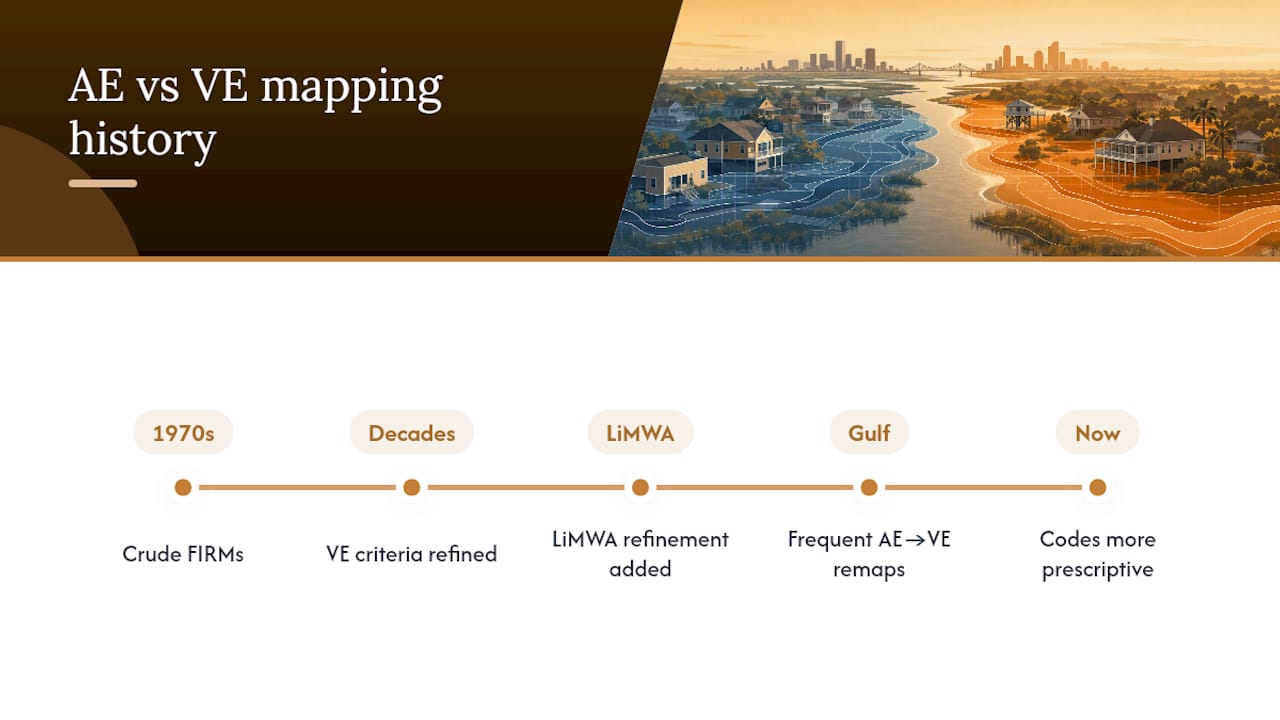
FEMA’s flood zone system has evolved considerably since the NFIP’s early mapping efforts in the 1970s. Early Flood Insurance Rate Maps used cruder wave-hazard estimates, and coastal high-hazard designations weren’t always separated as cleanly from stillwater flood zones as they are today.
The VE designation itself, and the technical runup criteria behind it, reflects decades of post-storm engineering review. Major hurricanes exposed how differently coastal structures fail compared to inland flood damage, and FEMA’s coastal mapping guidance has been revised repeatedly to sharpen the line between wave-driven and stillwater risk. The introduction of LiMWA mapping is a relatively recent refinement, born directly from observations that standard AE construction techniques failed under waves smaller than the VE threshold implied they should.
Louisiana’s own coastline has changed the mapping conversation further. Wetland loss, subsidence, and repeated major storms have pushed FEMA to update panels more frequently along the Gulf Coast than in many inland states, and some areas once mapped AE have shifted to VE as shoreline protection eroded. That’s a pattern worth remembering: your zone status isn’t permanent. A property that was comfortably AE a decade ago can be remapped as conditions on the ground change, and older maps should never be treated as current fact without verification.
Building codes have tracked this evolution too. The interaction between NFIP minimums and the International Codes and ASCE 24 standards has grown more detailed with each code cycle, adding more prescriptive requirements for foundations, flood openings, and design professional certification in high-hazard coastal areas.
Does a VE Designation Hurt Your Property’s Resale Value?
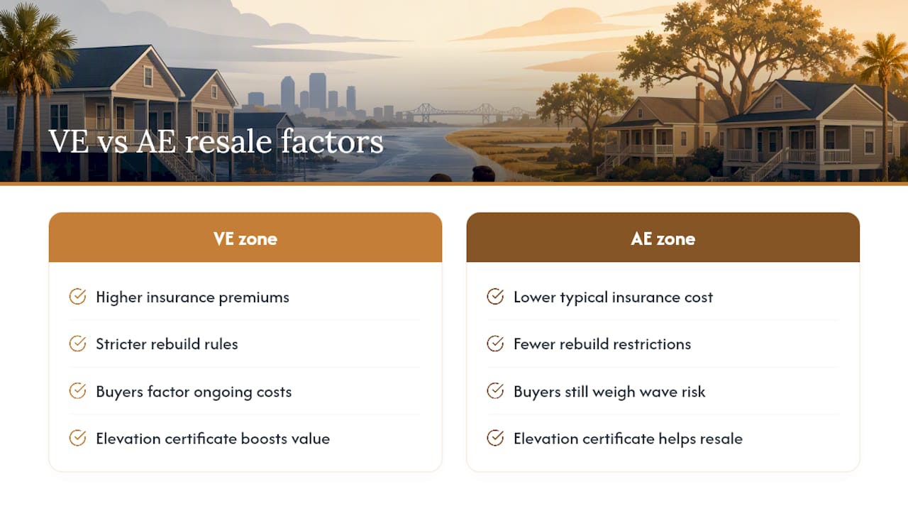
VE zone properties typically carry a real resale friction that AE properties don’t face to the same degree, and it comes down to the buyer’s total cost of ownership, not just the sale price. A VE home requires the buyer to absorb both higher flood insurance premiums and the knowledge that any future rebuild or major renovation must meet the stricter pile-foundation, breakaway-wall standards.
That doesn’t mean VE properties don’t sell, coastal Louisiana real estate proves otherwise every year, but savvy buyers factor the ongoing insurance cost into their offer. A well-elevated VE home with a strong elevation certificate and documented freeboard above the BFE competes far better than one sitting at minimum compliance, because the insurance savings from that extra elevation follow the property for as long as it stands.
AE properties near the LiMWA line face a quieter version of the same issue. Buyers who understand flood zones increasingly ask for elevation certificates and wave-hazard context even on AE listings, since a property just inland of the VE boundary can carry real wave risk that the zone label alone doesn’t communicate. Sellers who can produce clean documentation, current elevation certificates, LOMA paperwork, parish compliance records, generally close faster and face fewer renegotiations after inspection.
The practical takeaway for anyone selling or buying in either zone: documentation is leverage. A property with a verified, favorable elevation relative to its BFE holds value better than one where the buyer has to guess, regardless of whether the label reads AE or VE.
Steve Root’s Take: Coverage and a Local Agent Beat a Lower Premium
Whether you’re in AE or VE, the right coverage and an agent who answers the phone after a storm matter more than shaving a few dollars off your premium. That’s been true through every hurricane season I’ve worked in Louisiana over the past 20-plus years, and it’s why our 356 five-star reviews and our catastrophe response team exist in the first place.
— Steve Root
Get Your Flood Zone and Coverage Reviewed by a Local Expert
Reading a flood map correctly is one thing. Making sure your policy actually matches what that map requires is another, and it’s the step where too many Louisiana homeowners get caught underinsured after a storm. The Root Agency reviews your AE or VE designation against your actual policy, checks whether your elevation certificate supports a better rate, and walks you through NFIP and private flood options side by side.
We’re bilingual in English and Spanish, we offer 24/7 claims support, and we’re one of the only Louisiana agencies with a mobile catastrophe response unit that deploys directly to disaster zones when after a storm hits. That’s not theoretical. It’s the same team that shows up in person when your neighborhood is underwater. If you’re building, buying, or simply unsure whether your current policy reflects your real zone, request a flood insurance policy review from The Root Agency today, and get a straight answer from someone who’ll still be here after the next storm.
This article is general information, not a substitute for advice from a qualified financial advisor. Consult a qualified financial professional about your own circumstances before acting on anything here.